| FEDERAL PUBLICATIONS INC. |
| |
|
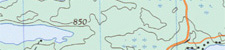
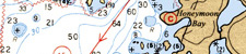
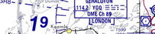
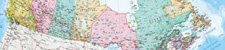
Maps and ChartsAs distributors of thousands of topographic maps, nautical and aeronautical charts from the Canadian government, plus other maps from commercial publishers, Federal Publications is your best source for maps of Canada. Our site is updated daily so you can be assured that the data on our website is the most current available.If you do not see what you are looking for, please feel free to ask us. |
| What's New · Home ·
Search ·
Books on Canada · Canadian
Maps and Charts · Ordering ·
Contact Us ©Federal Publications Inc., 1998 - 2016 425 University Avenue, Ste. 401, Toronto, Ontario, Canada M5G 1T6 Phone: (416) 860-1611 or toll-free 1-888-433-3782 · E-mail: info@fedpubs.com |