| |
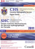
Canadian Hydrographic Service Digital Charts are
officially released CHS raster charts. ("Raster" is a computer generated image
that is a replica of the paper navigation chart - with the latitude and
longitude of the position of the cursor.) These CDs are designed for
recreational boaters and function with most navigational software.
The
current registration system requires customers to contact CHS via the internet
or telephone for the initial unlocking of the data. During this process the
customer is provided with a password from CHS. With this password customers can
unlock the data and copy it to their computer.
|
 |
The End User Licence Agreement (EULA) is valid for one year
from the date of purchase and entitles you to receive free updates for one year
from the date of purchase. Your product must be registered to receive updates.
After your one-year licence expires, if you wish to continue to receive chart
updates as well as new charts and new editions, you must purchase a new
CD-ROM.
The purchase of a Canadian Hydrographic Service Digital
Charts CD includes a licence for the installation, registration, decryption
and use of the charts on a primary device/computer, plus installation of one
backup on another device owned by the same user.
We also carry S-57
format ENCs for commercial navigation. Click
here for more details.
Navigation Software RequiredPlease note
that Canadian Hydrographic Service Digital Charts CD-ROMs
do not contain navigation software or chart viewing
software. Click here for more details.
All purchases of software are final. More information can be found in
our Return Policy.
2011 Editions are available for the all of the
following areas.
The 2011 Editions of
Canadian Hydrographic Service electronic charts are formatted to the BSB
V4.0 specification.
Georgian Bay $74.95
Lake Erie $49.95
Lake Huron/North Channel $74.95
Lake of the Woods $49.95
Lake Ontario $74.95
Lake Superior $49.95
Lakes and Rivers in Manitoba and Saskatchewan
$49.95
Lakes Around Georgian Bay
(Lake Muskoka, Lake Joseph, Lake Rosseau, Lake of Bays, Lake Nipissing,
Wahwashkesh Lake, interior lakes of Manitoulin Island)
$49.95
Kingston to
Montreal/Richelieu River $74.95
Montréal to Québec/Richelieu River
$49.95
Rainy Lake
$39.95
Rideau Canal/Ottawa
River $49.95
Trent Severn
Waterway $74.95
Gulf of St Lawrence North/Newfoundland
West $124.95
Gulf of St
Lawrence South $174.95
Labrador Coast $74.95
Newfoundland East and South $174.95
Nova Scotia South/Bay of Fundy $174.95
Québec to Anticosti
Island West $74.95
Lakes and Rivers of British Columbia
$49.95
Queen Charlotte
Sound/Hecate Strait to Portland Canal $174.95
Vancouver Island East $174.95
Vancouver Island West/Queen Charlotte Islands
$174.95
Northern Canada $99.95
|
|

