Federal Publications logo FEDERAL
PUBLICATIONS
INC.

Navigation Bar E-mail Us Canadian Maps and Charts Books on Canada Home

Adventure Maps®

Heading to the great outdoors? Whether you're canoeing, hiking, or camping in a popular recreation area, you'll enjoy the experience more with these maps.

If you do not see what you are looking for, please feel free to ask us.
This series of quality topographic maps features many of Canada's greatest National Parks, major Provincial and Territorial Parks and other popular wilderness recreation areas.
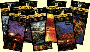
The Adventure Map® is specifically designed for outdoor adventurers such as hikers, backpackers, and paddling enthusiasts who need an accurate, up-to-date, rugged map to get them into and safely back from the wilderness.
The Adventure Map® is compact (most measure 18x24"/45x61cm or less), easy to read, and doesn't require instructions to help you with folding! The maps are also waterproof, printed on specially-made, extra tough, waterproof plastic.
The flip side of each sheet is filled with colour photos and important information about the area including natural and human history, local regulations, outdoor tips, safety concerns, addresses, useful phone numbers and more. There's also a detailed location map on the back cover.
Adventure Maps
In short, these Advenure Maps® are a great guide to the outdoors!


Park Maps

British Columbia

Glacier National Park - Rogers Pass $10.95
Kootenay National Park - The Rockwall $10.95
Lake O'Hara - Yoho National Park $8.95
Mount Revelstoke National Park$10.95

Nunavut

Akshayuk Pass - Auyuittuq National Park $19.95

Quebec

La Mauricie National Park $12.95

Ontario

Please click here

Your Guides

This new series of maps features all roads and highways, long distant trails, railways, recreation areas, conservation areas, provincial and national parks, historic features, hiking areas, biking areas, birding and fishing areas, canoe access points and many other attractions.
Scales range from 1:100,000 to 1:200,000 depending on the size and complexity of the area. One side of the sheet is a full colour map, the other side is covered by descriptive text and contact information plus colour photos.
Each map in the series has been developed in close consultation with local authorities.

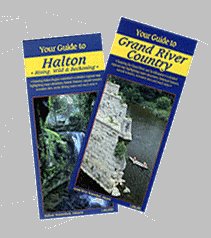
Your Guide to the City of Kawartha Lakes $5.95
Your Guide to Grand River Country $5.95 Regret, this is currently unavailable
Your Guide to Halton $5.95
Your Guide to Conservation Areas in Ontario $3.47

Browse By Type of Map:
  Topographic Maps
  Nautical Charts
  Aeronautical Charts
  Trak Maps and Charts
  Recreation Maps
  Park Maps
  Backroad Mapbooks

Browse By Region:
  Canada
  Alberta
  British Columbia
  Manitoba
  New Brunswick
  Newfoundland
  Northwest Territories
  Nova Scotia
  Ontario
  Prince Edward Island
  Quebec
  Saskatchewan
  Yukon
Featured Areas:
  Algonquin
  Killarney
  Temagami
  Banff
  Jasper
Outside Canada:
  Maps of the World
  North America

Related Reading:
  Hiking
  Paddling
  Outdoor Activities
  Nature Watching
Price and availability subject to change. Shipping and applicable taxes extra.

Can't find what you're looking for? Try the search button at the top of the page.
Questions about anything on this page? Please e-mail us.

Information on this page last updated: September 29, 2008

What's New · Home · Search · Books on Canada · Canadian Maps and Charts · Ordering · E-mail Us
©Federal Publications Inc., 1998 - 2016
425 University Avenue, Ste. 401, Toronto, Ontario, Canada M5G 1T6
Phone: (416) 860-1611 or toll-free 1-888-433-3782 · E-mail: info@fedpubs.com