| FEDERAL PUBLICATIONS INC. |
| |
|
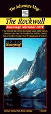
Kootenay National Park - The RockwallThe Adventure Map® |
 |
||
| Format | Waterproof folded map | |
| Catalogue No. | 0-929140-31-1 | |
| Scale | 1:50,000 | |
| Language | English only | |
| Price | $12.95 | |
| Not available for purchase at this time. |
| Published by Chrismar Mapping Services, 2002. Description: |
| Superb backcountry campsites and a network of over
100 km of hiking trails await your journey along The Rockwall, the towering
900-metre high face of rock overlooking some of the most spectacular scenes in
the Rockies. There are a variety of other easy to access attractions along Highway 93, including the Paint Pots, Marble Canyon, Numa Creek, Vermilion Crossing and the Kootenay Park Lodge. This 1:50,000 scale map covers the entire north end of Kootenay National Park and overlaps the Lake O'Hara - Yoho National Park map. Also shows a number of trails in adjacent Banff and Yoho National Parks. The Adventure Map® is specifically designed for outdoor adventurers such as hikers, backpackers, and paddling enthusiasts who need an accurate, up-to-date, rugged map to get them into and safely back from the wilderness. The Adventure Map® is compact (most measure 18" x 24"/45 x 61cm or less), easy to read, and easy to fold. The maps are also waterproof, printed on specially-made, extra tough, waterproof plastic. |
| Price and availability subject to change.
Shipping and applicable taxes extra. Questions about anything on this page? Please e-mail us. This page last modified: May 9, 2012 |
| Banff National Park main page · National Park Maps of Canada main page |
| What's New · Home · Search · Books on Canada · Canadian Maps and Charts · Ordering · Contact Us |
©Federal Publications Inc., 1998 - 2012 425 University Avenue, Ste. 401, Toronto, Ontario, Canada M5G 1T6 Phone: (416) 860-1611 or toll-free 1-888-433-3782 · E-mail: info@fedpubs.com |