| |
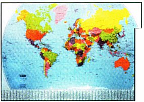
World Political Map
Paper
|
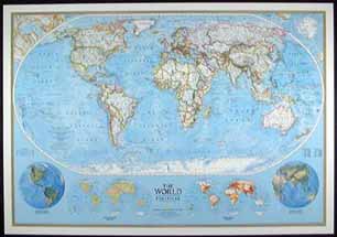 |
National Geographic production, featuring
Winkel Tripel projection, developed to show the round earth on flat paper with
minimal distortion. Inset maps illustrate vegetation, land use and population
density.
Published by National Geographic, 2006
Size: 49" x
70"
Scale: 1:24,031,000
|
Paper: 622008P $50.00
|
| |
Laminated: 622008L $99.00
|
World Physical Map/Ocean
Floor
|
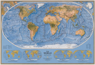 |
National Geographic production, paper format,
illustrates world relief including ocean floor.
Published by National
Geographic, 1999
Size: 43" x 30"
Scale: 1:38,931,000
Image not exact representation of map |
Paper: NW423 $25.00
|
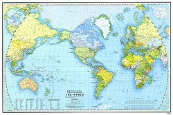
World Outstanding Wall
Map
|
Every
effort has been made to ensure this stunning new range of wall maps are the
most up to date and accurate available. Digital hill shading using the latest
techniques ensures a true impression of the Earth's relief. By choosing the
Miller Cylindrical Projection the extreme distortion associated with most maps
has been avoided.
Published by Outstanding UK Ltd, 2002 |
Small
Size: 21" x 27"
Scale: 1:60,000,000 |
Paper: 030536P $15.00
|
Laminated: 030536L $27.50
|
Medium
Size: 28.5" x
40"
Scale: 1:40,000,000 |
Paper: 03051P $25.00
|
Laminated: 03051L $50.00
|
Large
Size: 38" x 54"
Scale:
1:30,000,000 |
Paper: 03048P $27.50
|
Laminated: 03048L $60.00
|
Huge
Size: 48" x 77"
Scale:
1:20,000,000
** Note: Huge size does not include flags at borders of
map ** |
Paper: 125125P $50.00
Not
Available |
Laminated: 125125L $99.00
|
 |
The World map shows international boundaries
current to January 2000; and it shows the status (sovereign state or
dependency) for all countries. The map has a guide to aid users in finding
names for places, countries and features. Wherever possible, names on the map
are the locally-used forms. Other features include a table giving air distances
between major cities and a table listing two-letter abbreviations for selected
countries.
Published by Natural Resources Canada, 2005
Size: 32.5" x
48"
Scale: 1:35,000,000 |
Paper: MCR 0046 $10.75
|
 |
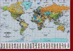
Basic political world map showing countries
and capitals, world place index, bilingual, includes Nunavut.
Published by
Mapart, 2010
Size: 28" x 40"
Scale: 1:40,500,000 |
Laminated:978-1-55198-811-5 $19.95
|
National Geographic
Decorator World Map
|
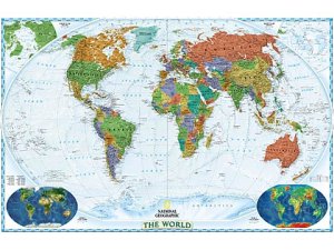 |
National Geographic production,
featuring Winkel Tripel projection, developed to show the round earth on flat
paper with minimal distortion. Inset maps illustrate vegetation, land use and
population density.
Published by National Geographic, 2008 |
Standard
Size: 43" x 30"
Scale:
1:38,931,000 |
Paper: 622077P $25.00
|
Laminated: 622077L $40.00
|
Huge
Size: 70" x 49"
Scale:
1:24,031,000 |
Paper: 622078P $50.00
|
Laminated: 622078L $99.00
|
National Geographic
Executive World Map
|
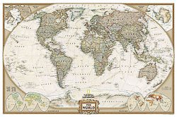 |
National Geographic production,
featuring Winkel Tripel projection, developed to show the round earth on flat
paper with minimal distortion. Inset maps illustrate vegetation, land use and
population density.
Published by National Geographic, 2008 |
Standard
Size: 43" x 30"
Scale:
1:38,931,000 |
Paper: 622085P $25.00
|
Laminated: 622085L $40.00
|
Huge
Size: 70" x 49"
Scale:
1:24,031,000 |
Paper: 622086P $50.00
|
Laminated: 622086L $99.00
|
National Geographic Explorer World Map
|
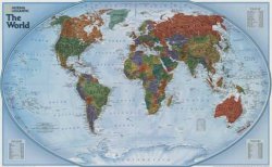 |
National Geographic production,
featuring Winkel Tripel projection, developed to show the round earth on flat
paper with minimal distortion.
Published by National Geographic, 2008 |
Standard
Size: 32" x 20"
Scale:
1:51,969,000 |
Paper: 622089P $15.00
|
Laminated: 622089L $25.00
|
Brilliant Earth Satellite
Poster
|
 |
Satellite image of the earth at
night.
Published by Map Appeal Inc., 1998 |
Standard
Size: 24" x 36" |
Paper: ASP-BRILLEARTH
on sale $10.00 (reduced from $16.95)
|
|
|