| FEDERAL PUBLICATIONS INC. |
| |
|
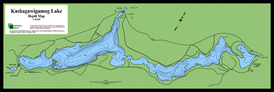
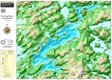
Depth MapsFederal Publications carries a series of regional topographic maps and bathymetric maps that provide detailed land and water mapping of many areas throughout Ontario.Bathymetric WallmapsWe carry bathymetric charts covering some of the province's most popular lakes and waterways. Each chart indicates water depths by isobaths and colour gradients. Please note that these maps are not recommended for navigational purposes. |
Kashagawigamog Lake
Kennisis Lake
|
|
|||||||||||||||||||||||||||||||||||||||||||||||||||||||||||||||||||||||||||||||||||
|
| What's New · Home
· Search · Books on Canada · Canadian Maps and Charts · Ordering · E-mail Us ©Federal Publications Inc., 1998 - 2016 425 University Avenue, Ste. 401, Toronto, Ontario, Canada M5G 1T6 Phone: (416) 860-1611 or toll-free 1-888-433-3782 · E-mail: info@fedpubs.com |