| |
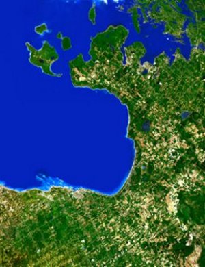
Southern Georgian Bay
Collingwood |
 |
Size: 19" x 26½"
Scale: 1:110,000
Paper:
ASP-S.Georg Bay on
sale $10.00 (reduced from $16.95)

|
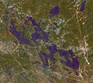
Muskoka Lakes Lake of
Bays |
 |
Size: 25½" x 28"
Scale:
1:110,000
Paper:
ASP-Muskoka Lks on
sale $10.00 (reduced from $16.95)
|
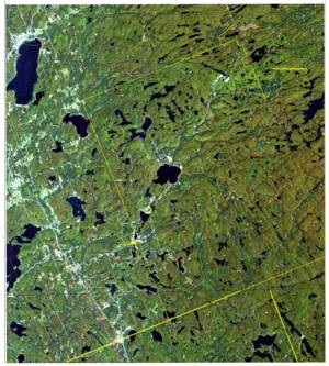
South-East Almaguin
Highlands |
 |
Size: 33 3/4" x 22" (86 cm x 55
cm)
Ecomaps are a product derived from digital Satellite imagery,
combined with vector based line data and GIS objects comprising combinations of
roads, trails, ecological/environmental features etc. Unlike topographic maps
and derived products, satellite imagery provides a true and current picture of
the land features represented by the coverage area such as: agriculture and
urban development, forest and wetland areas etc.
Text shows towns, lakes
and township boundaries.
Paper:
ECOMAP2 on sale $10.00 (reduced
from $16.95)
|
|
|