Contents include the following topos:
|
 |
All purchases of software are final. More information can be found in our Return Policy.
BCBSB1 $30.00
Fugawi Topographic Maps on CD-ROM |
Digital topographic maps on CD-ROM are now available through Federal Publications. Each CD-ROM can be used on its own using the built-in viewer, or it may be used in conjunction with the Fugawi Global Navigator GPS Moving Map software. |
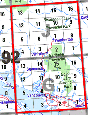
Fugawi: Vancouver to Whistler CD-ROM |
This CD-ROM contains 34 GPS-ready topographic maps, in 1:50,000 and
1:250,000 scales. Maps may be viewed using the built-in viewer, or may be
viewed in conjunction with the Fugawi navigation software. Resolution: 5 meters
per pixel for the 1:50,000 maps. 254 dpi. BSB Format
All purchases of software are final. More information can be found in our Return Policy. BCBSB1 $30.00 |
Fugawi: Klondike - Dempster Highway CD-ROM |
| The Klondike Highway and Dempster Highway from Whitehorse, Yukon
Territory to Inuvik, Northwest Territories. Each CD contains 7 1:250:000 ADRG
images converted to Fugawi export format. These NTS maps cover an area
comprised of 32 1:250,000 scale and can easily be brought into Fugawi for GPS
navigation. All purchases of software are final. More information can be found in our Return Policy. YUK-1KDHWY (PPSI) $30.00 |
System Requirements
|
| Top of Page |
| Price and availability subject to change.
Shipping and applicable taxes extra. Questions about anything on this page? Please e-mail us. This page last modified: December 29, 2005 |
| Topographic Maps on CD-ROM main page · Maps and Charts main page |
| What's New · Home · Search · Books on Canada · Canadian Maps and Charts · Ordering · E-mail Us |
©Federal Publications Inc., 1998 - 2016 165 University Avenue, Toronto, Ontario, Canada M5H 3B8 Phone: (416) 860-1611 or toll-free 1-888-433-3782 · E-mail: info@fedpubs.com |