| FEDERAL PUBLICATIONS INC. |
| |
|
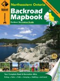
Northeastern Ontario Backroad Mapbook, 3rd Edition |
 |
||
| Format | Spiral-bound | |
| Catalogue No. | 978-1-926806-31-0 | |
| Pages | 167 | |
| Language | English only | |
| Price | $25.95 | |
Written by Robert Causley. Published by Mussio Ventures Ltd., 2011. Description: |
| Whether you're
driving, cycling, hiking or camping, find your way with this complete road and
recreation atlas. The Northeastern Ontario Backroad Mapbook, 3rd Edition is the most comprehensive outdoor recreational resource available for the Northeastern Ontario region, a sprawling area that encompasses the Canadian Shield, farmlands, and thousands of miles of boreal forest. Although this vast area has relatively few people, it has seen significant recreational development. The area is well known as one of the best canoeing and fishing destinations in the world. Killarney Provincial Park, Lake Superior Provincial Park and the Temagami areas are particularly popular with canoe trippers. It is also a paradise for those who love outdoor winter activities, due to its long winters and heavy snowfalls. The reference section found in this book includes information on multi-use trails, lake and stream fishing, provincial parks and conservation areas, paddling, wilderness camping and winter recreation. The maps in this book highlight the logging/bush road network, trail systems and recreation opportunities for Northeastern Ontario. A unique feature of the maps is that all recreation activities are labelled, allowing for quick and easy referencing when researching a specific area. The 3rd Edition features an expanded hunting section that provides information on each Wildlife Management Unit, updated fishing and stocking information, shading to denote Crown Land, as well as new road systems and trails. No other source provides as much detail and accuracy on the road and trail networks of Northeastern Ontario. |
|
 |
|
Also available: Other Backroad Mapbooks Travelling to Killarney? You may also be interested in other maps and books about Killarney. |
| Price and availability subject to change.
Shipping and applicable taxes extra. Questions about this product? Please e-mail us. This page last modified: October 31, 2011 |
| Travel in Ontario main page · Maps of Ontario main page |
| What's New · Home · Search · Books on Canada · Canadian Maps and Charts · Ordering · Contact Us |
©Federal Publications Inc., 1998 - 2011 425 University Avenue, Ste. 401, Toronto, Ontario, Canada M5G 1T6 Phone: (416) 860-1611 or toll-free 1-888-433-3782 · E-mail: info@fedpubs.com |