| FEDERAL PUBLICATIONS INC. |
| |
|
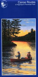
Canoe Routes of Algonquin Provincial Park |
 |
||
| Format | Paper map | |
| Catalogue No. | 978-1-894993-36-4 | |
| Language | English only | |
| Price | $6.50 | |
Published by The Friends of Algonquin Park, 2011. Description: |
| Canoe Routes of Algonquin Provincial Park is a detailed
map at a scale of 1:126 720 (one inch to two miles) showing Algonquin's entire
7725 square kilometres and outlining over 1600 km of portages and 1500 lakes.
The front side of this map displays the Park's 29 access points as well as Hwy.
60 corridor which boasts 8 campgrounds. Portages and campsites are marked
accordingly. The reverse side of this map answers general questions about the Park. It provides readers with rates associated with visiting and camping within Algonquin Provincial Park. There are useful tips and directions for canoeists as well as hints for the trip itself. This map is essential to truly enjoy Algonquin Provincial Park by canoe. Travelling to Algonquin? You may also be interested in other maps and books about Algonquin Provincial Park. |
| Price and availability subject to change.
Shipping and applicable taxes extra. Questions about this product? Please e-mail us. This page last modified: August 16, 2011 |
| Algonquin Provincial Park page · Paddling main page · Recreational Maps |
| What's New · Home · Search · Books on Canada · Canadian Maps and Charts · Ordering · Contact Us |
©Federal Publications Inc., 1998 - 2011 425 University Avenue, Ste. 401, Toronto, Ontario, Canada M5G 1T6 Phone: (416) 860-1611 or toll-free 1-888-433-3782 · E-mail: info@fedpubs.com |