| FEDERAL PUBLICATIONS INC. |
| |
|
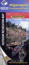
Algonquin Provincial Park Outdoor Recreation Map, 2nd Edition |
 |
||
| Format | Waterproof map | |
| Catalogue No. | 978-1-897225-58-5 | |
| Language | English only | |
| Price | $10.95 | |
| Published by Mussio Ventures Ltd., 2008. Description: |
| The Algonquin Provincial Park Outdoor Recreation
Map is a detailed topographic map at a scale of 1:125 000. This map is
truly unique, combining information from the Algonquin Region Backroad Mapbook with the
most up to date and accurate Algonquin Provincial Park information available.
The most striking feature of the park map is the revolutionary topographic and
relief shading, combining elevation information with recreational information
on park trails and canoe routes. The addition of relief topography allows you a better planning tool to help spot those more challenging portages or prominent viewpoints on the trails that make Algonquin Park so special. In addition to the new elevation information, this park map is printed on tear proof and water resistant paper. So do your park adventures, rain or shine. |
| Price and availability subject to change.
Shipping and applicable taxes extra. Questions about this product? Please e-mail us. This page last modified: August 27, 2008 |
| Algonquin Provincial Park page · Paddling main page · Recreational Maps |
| What's New · Home · Search · Books on Canada · Canadian Maps and Charts · Ordering · Contact Us |
©Federal Publications Inc., 1998 - 2011 425 University Avenue, Ste. 401, Toronto, Ontario, Canada M5G 1T6 Phone: (416) 860-1611 or toll-free 1-888-433-3782 · E-mail: info@fedpubs.com |