| FEDERAL PUBLICATIONS INC. |
| |
|
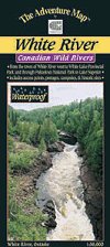
White RiverThe Adventure Map® |
 |
||
| Format | Waterproof folded map | |
| Catalogue No. | 0-929140-64-8 | |
| Scale | 1:50,000 | |
| Language | English only | |
| Price | $12.95 | |
| Not available for purchase at this time. |
| Published by Chrismar Mapping Services, 2003. Description: |
| One of Ontario's few remaining easily accessible
wilderness white water paddling routes. An excellent combination of some
flatwater paddling, light and heavy white water sections and some paddling on
the inland sea, Lake Superior. Starting at the Town of White River on Hwy 17
north of Wawa, this map shows details of the 145-kilometre route across and
down the Canadian Shield to Lake Superior and Pukaskwa National
Park. This 1:50,000 topographic scale map has unprecedented detail, and includes access points, campsites, portages, plus many other features. The back side includes a complete description of the route, natural and human history, safety concerns, contact info and fine colour photographs. The Adventure Map® is specifically designed for outdoor adventurers such as hikers, backpackers, and paddling enthusiasts who need an accurate, up-to-date, rugged map to get them into and safely back from the wilderness. The Adventure Map® is compact (most measure 18" x 24"/45 x 61cm or less), easy to read, and easy to fold. The maps are also waterproof, printed on specially-made, extra tough, waterproof plastic. |
Price and availability subject to change. Shipping and applicable taxes extra. Questions about anything on this page? Please e-mail us. This page last modified: August 19, 2011 |
| Recreation Maps main page |
| What's New · Home · Search · Books on Canada · Canadian Maps and Charts · Ordering · Contact Us |
©Federal Publications Inc., 1998 - 2016 425 University Avenue, Ste. 401, Toronto, Ontario, Canada M5G 1T6 Phone: (416) 860-1611 or toll-free 1-888-433-3782 · E-mail: info@fedpubs.com |