| FEDERAL PUBLICATIONS INC. |
| |
|
Recreational Trails Maps |
Heading to the great outdoors? Whether you're biking, hiking, walking or sightseeing, you'll enjoy the experience more with these maps.If you do not see what you are looking for, please feel free to ask us. |
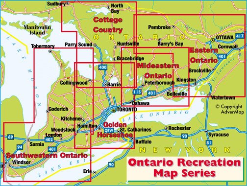
Coverage Areas |
 |
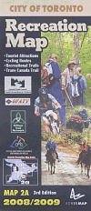
City of Toronto Recreation Map3rd Edition, 2008/2009 |
 |
||
| Catalogue No. | ADVERMAP2A | |
| Price | $5.95 | |
| Format | Folded map | |
| Language | English only | |
| Not available for purchase at this time. New edition due Fall 2012. |
| Published by Advermap, 2008. Description: |
| The City of Toronto Recreation Map, 3rd edition, is a 1:31
250 road map containing 29 cycling loops of varying lengths, as well as in-line
skating, hiking, skateboarding and jogging routes throughout Toronto. An
essential resource for any outdoor activity within the city
limits. Please see above for coverage area. |
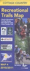
Cottage Country Recreational Trails Map5th Edition, 2010/2011 |
 |
||
| Catalogue No. | ADVERMAP4 | |
| Price | $5.95 | |
| Format | Folded map | |
| Language | English only | |
| Not available for purchase at this time. New edition due Fall 2012. |
| Published by Advermap, 2010. Description: |
| The Cottage Country Recreational Trails Map, 5th edition,
is a 1:250 000 road map containing 30 cycling loops of varying lengths, as well
as in-line skating, hiking, skateboarding and jogging routes throughout
Ontario's Cottage Country. Stretching from Orillia to North Bay, and
Wilberforce to Sudbury, the map is an essential resource for any outdoor
activity in cottage country. Please see above for coverage area. |
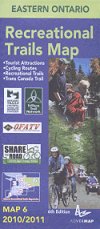
Eastern Ontario Recreational Trails Map6th Edition, 2010/2011 |
 |
||
| Catalogue No. | ADVERMAP6 | |
| Price | $5.95 | |
| Format | Folded map | |
| Language | English only | |
| Not available for purchase at this time. New edition due Fall 2012. |
| Published by Advermap, 2010. Description: |
| The Eastern Ontario Recreational Trails Map, 6th edition,
is a 1:250 000 road map detailing 56 on-road and off-road cycling routes and
loops throughout the eastern Ontario Region. Stretching east from Kingston, the
Ontario East Cycling Map is an essential resource for any cycling
adventure. Please see above for coverage area. Previous edition titled: Ontario East Recreational Trails Map. |
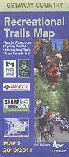
Getaway Country Recreational Trails Map6th Edition, 2010/2011(formerly titled Mideastern Ontario/City of Kingston Recreational Trails Map) |
 |
||
| Catalogue No. | ADVERMAP5 | |
| Price | $5.95 | |
| Format | Folded map | |
| Language | English only | |
| Published by Advermap, 2010. Description: |
| The Getaway Country Recreational Trails Map, 6th edition,
is a 1:250 000 road map detailing the Trans Canada Trail, 34 on-road and
off-road cycling routes and loops, walking and hiking trails, as well as
tourist attractions throughout the mideastern Ontario Region. Stretching from
Port Hope to Smiths Falls, Bancroft to Lake Ontario, and including a detailed
city map of Kingston, the Mideastern Ontario City of Kingston Recreational
Trails Map is an essential resource for any outdoor activity. Please see above for coverage area. Previous edition titled: Mideastern Ontario City of Kingston Recreational Trails Map. |
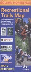
Golden Horseshoe Recreational Trails Map8th Edition, 2010/2011 |
 |
||
| Catalogue No. | ADVERMAP2 | |
| Price | $5.95 | |
| Format | Folded map | |
| Language | English only | |
| Not available for purchase at this time. New edition due Fall 2012. |
| Published by Advermap, 2010. Description: |
| The Golden Horseshoe Recreational Trails Map, 8th edition,
is a 1:250 000 road map detailing the Trans Canada Trail, 122 on-road and
off-road cycling routes and loops, walking and hiking trails, as well as
tourist attractions throughout the southern Ontario Region. Stretching from
Kitchener to Oshawa, Gravenhurst to the Niagara Peninsula, the map is an
essential resource for any outdoor activity. Please see above for coverage area. |
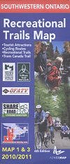
Southwestern Ontario Recreational Trails Map6th Edition, 2010/2011 |
 |
||
| Catalogue No. | ADVERMAP1/3 | |
| Price | $5.95 | |
| Format | Folded map | |
| Language | English only | |
| Not available for purchase at this time. New edition due Fall 2012. |
| Published by Advermap, 2010. Description: |
| The Southwestern Ontario Recreational Trails Map, 6th
edition, is a 1:250 000 road map detailing 124 on-road and off-road cycling
routes and loops throughout Southwestern Ontario. Stretching west from Guelph
and including the Bruce Peninsula, the Southwestern Ontario Recreational
Trails Map is an essential resource for any cycling adventure.
Please see above for coverage area. |
Price and availability subject to change. Shipping and applicable taxes extra. Questions about anything on this page? Please e-mail us. Last modified: August 8, 2012 |
| Outdoor Activities main page · Recreation Maps main page |
| What's New · Home · Search · Books on Canada · Canadian Maps and Charts · Ordering · Contact Us |
©Federal Publications Inc., 1998 - 2012 425 University Avenue, Ste. 401, Toronto, Ontario, Canada M5G 1T6 Phone: (416) 860-1611 or toll-free 1-888-433-3782 · E-mail: info@fedpubs.com |