| FEDERAL PUBLICATIONS INC. |
| |
|
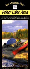
Poker Lake AreaThe Adventure Map® |
 |
||
| Format | Waterproof folded map | |
| Catalogue No. | 0-929140-61-3 | |
| Scale | 1:15,000 | |
| Language | English only | |
| Price | $6.95 | |
| Published by Chrismar Mapping Services, 2009. Description: |
| The Poker Lake System is a compact paddling area on
crown land just west of Carnarvon in Haliburton County. It's perfect for family
canoeing, day paddles and 2-3 night trips. The area straddles Hwy 118 with a
network of smaller lakes on the north side and large multi-bayed Big East Lake
on the south side. This 1:15,000 large-scale map covers the entire paddling area and then some. As usual, the map is waterproof and highlights portages, campsites, rapids, falls and other important features. The Adventure Map® is specifically designed for outdoor adventurers such as hikers, backpackers, and paddling enthusiasts who need an accurate, up-to-date, rugged map to get them into and safely back from the wilderness. The Adventure Map® is compact (most measure 18" x 24"/45 x 61cm or less), easy to read, and easy to fold. The maps are also waterproof, printed on specially-made, extra tough, waterproof plastic. |
| Price and availability subject to change.
Shipping and applicable taxes extra. Questions about anything on this page? Please e-mail us. This page last modified: December 2, 2009 |
| Recreation Maps main page |
| What's New · Home · Search · Books on Canada · Canadian Maps and Charts · Ordering · Contact Us |
©Federal Publications Inc., 1998 - 2016 425 University Avenue, Ste. 401, Toronto, Ontario, Canada M5G 1T6 Phone: (416) 860-1611 or toll-free 1-888-433-3782 · E-mail: info@fedpubs.com |