| FEDERAL PUBLICATIONS INC. |
| |
|
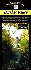
Dundas ValleyThe Adventure Map® |
 |
||
| Format | Waterproof folded map | |
| Catalogue No. | 0-929140-73-7 | |
| Scale | 1:10,000 | |
| Language | English only | |
| Price | $8.95 | |
| Published by Chrismar Mapping Services, 2003. Description: |
| A wilderness conservation area between the towns of
Ancaster and Dundas, this area is popular with hikers, mountain bikers, and
horseback riders looking for extensive trails and solitude among the rolling
hills and beautiful scenery of the Niagara Escarpment. Also includes a section
of the Bruce Trail. The scale of 1:10,000 ensures lots of trail, topographic and vegetation detail, and on the back side there's colour photos and text details about local history, flora and fauna, trail descriptions, safety concerns, contact info and more. This map has been adopted as the official map of Dundas Valley by the Hamilton Region Conservation Authority. The Adventure Map® is specifically designed for outdoor adventurers such as hikers, backpackers, and paddling enthusiasts who need an accurate, up-to-date, rugged map to get them into and safely back from the wilderness. The Adventure Map® is compact (most measure 18" x 24"/45 x 61cm or less), easy to read, and easy to fold. The maps are also waterproof, printed on specially-made, extra tough, waterproof plastic. |
| Price and availability subject to change.
Shipping and applicable taxes extra. Questions about anything on this page? Please e-mail us. This page last modified: April 19, 2011 |
| Recreation Maps main page |
| What's New · Home · Search · Books on Canada · Canadian Maps and Charts · Ordering · Contact Us |
©Federal Publications Inc., 1998 - 2016 425 University Avenue, Ste. 401, Toronto, Ontario, Canada M5G 1T6 Phone: (416) 860-1611 or toll-free 1-888-433-3782 · E-mail: info@fedpubs.com |