| FEDERAL PUBLICATIONS INC. |
| |
|
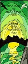
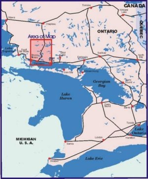
Blind River to Bruce Mines Area Fishing & Recreation Map |
 |
||
| Format | Paper folded map | |
| Catalogue No. | CGIS4 | |
| Scale | 1:750,000 | |
| Language | English only | |
| Price | $14.95 | |
| Published by Coordinate GIS, 2002. Description: |
| Blind River to Bruce Mines Area Fishing &
Recreation Map is a full-colour map at a scale of 1:750,000. It comes
pre-folded, and unfolds to 27.5" x 40". The map shows:
|
 |
| Price and availability subject to change.
Shipping and applicable taxes extra. Questions about anything on this page? Please e-mail us. This page last modified: April 19, 2011 |
| Outdoor Activities main page · Recreation Maps main page |
| What's New · Home · Search · Books on Canada · Canadian Maps and Charts · Ordering · Contact Us |
©Federal Publications Inc., 1998 - 2016 425 University Avenue, Ste. 401, Toronto, Ontario, Canada M5G 1T6 Phone: (416) 860-1611 or toll-free 1-888-433-3782 · E-mail: info@fedpubs.com |