Federal Publications logo FEDERAL
PUBLICATIONS
INC.

Navigation Bar Checkout View Cart Contact Us Canadian Maps and Charts Books on Canada Home

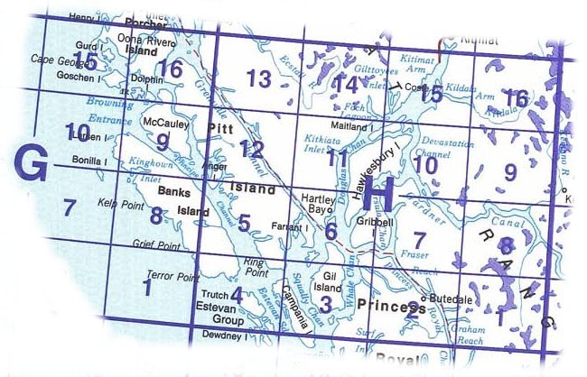
Topographic Map Index: 103H Douglas Channel, British Columbia

North of this Map North East
West of this Map 103H Douglas Channel, British Columbia 103H16 Kildala Arm 103H15 Kitimat Arm 103H14 Foch Lagoon 103H13 Kumealon Lake 103H12 Lowe Inlet 103H11 Kitkiata Inlet 103H10 Devastation Channel 103H09 Brim River 103H08 Gardner Canal 103H07 Ursula Channel 103H06 Hartley Bay 103H05 Port Stephens 103H04 Trutch Island 103H03 Gil Island 103H02 Butedale 103H01 Khutze River 103G16 Oona River 103G15 Kitkatla Inlet 103G10 Griffith Harbour 103G09 McCauley Island 103G08 Banks Lakes 103G07 Bonilla Island East of this Map
South West South of this Map South East

  • Paper maps and Waterpoof maps are normally sent pre-folded. If you would prefer that we send them rolled in a tube, please specify in the Special Handling Instructions field on our Shipping Information page during checkout.
  • Topographic maps show the detail of the land - surface features only. We also sell nautical charts with the depths of major waterways.
Map Number Scale Name Paper
$11.45
Waterproof
$15.95
103H 1:250,000 Douglas Channel Add to Cart Add to Cart
103H01 1:50,000 Khutze River Add to Cart Add to Cart
103H02 1:50,000 Butedale Add to Cart Add to Cart
103H03 1:50,000 Gil Island Add to Cart Add to Cart
103H04 1:50,000 Trutch Island Add to Cart Add to Cart
103H05 1:50,000 Port Stephens Add to Cart Add to Cart
103H06 1:50,000 Hartley Bay Add to Cart Add to Cart
103H07 1:50,000 Ursula Channel Add to Cart Add to Cart
103H08 1:50,000 Gardner Canal Add to Cart Add to Cart
103H09 1:50,000 Brim River Add to Cart Add to Cart
103H10 1:50,000 Devastation Channel Add to Cart Add to Cart
103H11 1:50,000 Kitkiata Inlet Add to Cart Add to Cart
103H12 1:50,000 Lowe Inlet Add to Cart Add to Cart
103H13 1:50,000 Kumealon Lake Add to Cart Add to Cart
103H14 1:50,000 Foch Lagoon Add to Cart Add to Cart
103H15 1:50,000 Kitimat Arm Add to Cart Add to Cart
103H16 1:50,000 Kildala Arm Add to Cart Add to Cart
103G07 1:50,000 Bonilla Island Add to Cart Add to Cart
103G08 1:50,000 Banks Lakes Add to Cart Add to Cart
103G09 1:50,000 McCauley Island Add to Cart Add to Cart
103G10 1:50,000 Griffith Harbour Add to Cart Add to Cart
103G15 1:50,000 Kitkatla Inlet Add to Cart Add to Cart
103G16 1:50,000 Oona River Add to Cart Add to Cart

Not sure which map covers the exact place you're looking for?
Try the online "search by map number, place name, or coordinates" website.

Index to adjoining maps:
  103J 103I 093L  
  103G 103H 093E  
  103B 103A 093D  


Price and availability subject to change. Shipping and applicable taxes extra.
Questions about anything on this page? Please e-mail us.
This page last modified: April 26, 2012

British Columbia Topographic Index
What's New · Home · Search · Books on Canada · Canadian Maps and Charts · Ordering · Contact Us

©Federal Publications Inc., 1998 - 2012
425 University Avenue, Ste. 401, Toronto, Ontario, Canada M5G 1T6
Phone: (416) 860-1611 or toll-free 1-888-433-3782 · E-mail: info@fedpubs.com