| FEDERAL PUBLICATIONS INC. |
| |
|
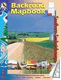
Southern Saskatchewan Backroad Mapbook |
 |
||
| Format | Spiral-bound | |
| Catalogue No. | 1-894556-65-8 | |
| Pages | 120 | |
| Language | English only | |
| Price | $19.95 | |
Written by Linda Aksomitis. Published by Mussio Ventures Ltd., 2005. Description: |
| Whether you're
driving, cycling, hiking or camping, find your way with this complete road and
recreation atlas. The Southern Saskatchewan Backroad Mapbook is the most comprehensive outdoor recreation resource available for Southern Saskatchewan. As you travel north and south along the Saskatchewan-Alberta border you will find the highest point between the Rocky Mountains and Labrador in the incredible Cypress Hills and its lodgepole pine forests. You will also discover the Great Sand Hills, with their incredible shifting sands. The Trans-Canada Highway running west to east cuts through the great prairie area. But if you leave the ribbon of asphalt, in less than half an hour's drive you will find yourself following first the South Saskatchewan River at the Alberta border, into Lake Diefenbaker, then the Qu'Appelle Valley with its chain of lakes, until you reach the Manitoba border. Whatever kind of outdoor recreation you are looking for you can find it a stone's throw from the Trans-Canada Highway. The reference section includes information on lake and stream fishing, paddling routes, multi-use trails (hiking/biking/ATV), wilderness camping (parks and conservation areas), and winter recreation. The maps highlight the provincial road networks, trail systems and recreation opportunities for Southern Saskatchewan. Whether fishing, paddling, ATVing, snowmobiling, or bird watching, the Southern Saskatchewan Backroad Mapbook is much more than a set of maps - it is an explorer's guide. |
|
 |
|
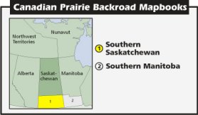
Also available: Other Backroad Mapbooks |
| Price and availability subject to change.
Shipping and applicable taxes extra. Questions about this product? Please e-mail us. This page last modified: January 10, 2011 |
| Travel in Canada main page · Maps of Saskatchewan main page |
| What's New · Home · Search · Books on Canada · Canadian Maps and Charts · Ordering · Contact Us |
©Federal Publications Inc., 1998 - 2011 425 University Avenue, Ste. 401, Toronto, Ontario, Canada M5G 1T6 Phone: (416) 860-1611 or toll-free 1-888-433-3782 · E-mail: info@fedpubs.com |