| FEDERAL PUBLICATIONS INC. |
| |
|
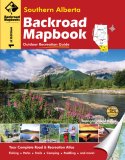
Southern Alberta Backroad Mapbook, 1st Edition |
 |
||
| Format | Spiral-bound | |
| Catalogue No. | 978-1-897225-29-5 | |
| Pages | 117 | |
| Language | English only | |
| Price | $24.95 | |
Written by Trent Ernst. Published by Mussio Ventures Ltd., 2008. Description: |
| Whether you're
driving, cycling, hiking or camping, find your way with this complete road and
recreation atlas. The Southern Alberta Backroad Mapbook covers a large area that is bound by the David Thompson Highway to the north, Saskatchewan to the east, and British Columbia and the United States to the west and south. This is an area of dramatic contrast - where the prairies butt against towering mountain peaks, and the temperatures can vary almost 80 degrees Celsius between summer and winter. It is also an area of incredible beauty. There are few roads more dramatic than the Icefields Parkway in Banff, few hikes as breathtaking as the Crypt Lake hike in Waterton, and few campsites as nice as the ones you will find on the shores of Kananaskis Lake in Peter Lougheed Provincial Park. The reference section includes information on lake and stream fishing, paddling routes, multi-use trails (hiking/biking/ATV), wilderness camping (parks and conservation areas), and winter recreation. The maps highlight the logging/bush road networks, trail systems and recreation opportunities for Southwestern Alberta. Whether fishing, paddling or hiking, the Southern Alberta Backroad Mapbook is much more than a set of maps - it is an explorer's guide. |
|
 |
|
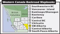
Also available: Other Backroad Mapbooks |
| Price and availability subject to change.
Shipping and applicable taxes extra. Questions about this product? Please e-mail us. This page last modified: January 10, 2011 |
| Travel in Canada main page · Maps of Alberta main page |
| What's New · Home · Search · Books on Canada · Canadian Maps and Charts · Ordering · Contact Us |
©Federal Publications Inc., 1998 - 2011 425 University Avenue, Ste. 401, Toronto, Ontario, Canada M5G 1T6 Phone: (416) 860-1611 or toll-free 1-888-433-3782 · E-mail: info@fedpubs.com |