| FEDERAL PUBLICATIONS INC. |
| |
|
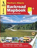
Northern Alberta Backroad Mapbook |
| May 31, 2011: The 2nd edition of the
Northern Alberta Backroad Mapbook is due to be published in fall 2011. If you'd
like to be notified when the new edition is available to order, please
contact
us. We no longer have stock of the 1st edition. |
 |
||
| Format | Spiral-bound | |
| Catalogue No. | 978-1-897225-12-7 | |
| Pages | 127 | |
| Language | English only | |
| Price | $24.95 | |
| Not available for purchase at this time – new edition forthcoming |
Written by Trent Ernst. Published by Mussio Ventures Ltd., 2007. Description: |
| Whether you're
driving, cycling, hiking or camping, find your way with this complete road and
recreation atlas. The Northern Alberta Backroad Mapbook is the most comprehensive outdoor recreation resource available for Northern Alberta, a sprawling area that encompasses mountains, prairies, Canadian Shield, and miles upon endless miles of boreal forest. As you travel north along the BC/Alberta boundary, the Rocky Mountains begin to change. They are less sharp and jagged, taking on a more rounded appearance. The mountains also begin to shuffle further west, until finally the continental divide spills over into BC near the northern end of Willmore Wilderness Park. While there are still mountains north of here, they are small, never topping 1,500 metres (4,900 feet). As you head farther east, the landscape changes, turning first into northernmost prairie in Canada, and then into boreal forest that dominates the north. Finally, you will find an area of Canadian Shield in the northeastern corner of the province around Lake Athabasca. Paddlers will love Northern Alberta. Some of Canada’s greatest touring rivers flow through this area. These are big rivers, and trips can last weeks and even months making proper planning that much more essential. People who are interested in exploring trails will find a wide variety of options. The most notable development is the Trans Canada Trail, which follows established trails and historic routes across large tracts of the north. Others simply enjoy cruising backroads and endless miles of cutlines on their ATV or snowmobile. Anglers and hunters will also find this region an absolute paradise. Not only is Lesser Slave Lake the best place in Alberta to fish for walleye, some of Canada’s best rainbow trout fishing lakes are found in this region. Stream fishers will be delighted to know that there are some fine creeks and rivers, especially near the mountains. Hunters will be astounded with the number and variety of wildlife in this area. It is not uncommon to see several moose, herds of elk, a bear or two and scores of deer when driving around the backroads of the region. The reference section includes information on lake and stream fishing, paddling routes, multi-use trails (hiking/biking/ATV), wilderness camping (parks and conservation areas), and winter recreation. The maps highlight the logging/bush road networks, trail systems and recreation opportunities for Northern Alberta. Whether fishing, paddling or hiking, the Northern Alberta Backroad Mapbook is much more than a set of maps - it is an explorer's guide. |
|
 |
|
Also available: Other Backroad Mapbooks |
| Price and availability subject to change.
Shipping and applicable taxes extra. Questions about this product? Please e-mail us. This page last modified: May 31, 2011 |
| Travel in Canada main page · Maps of Alberta main page |
| What's New · Home · Search · Books on Canada · Canadian Maps and Charts · Ordering · Contact Us |
©Federal Publications Inc., 1998 - 2011 425 University Avenue, Ste. 401, Toronto, Ontario, Canada M5G 1T6 Phone: (416) 860-1611 or toll-free 1-888-433-3782 · E-mail: info@fedpubs.com |