| FEDERAL PUBLICATIONS INC. |
| |
|
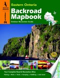
Eastern Ontario Backroad Mapbook, 3rd Edition |
 |
||
| Format | Spiral-bound | |
| Catalogue No. | 978-1-897225-67-7 | |
| Pages | 133 | |
| Language | English only | |
| Price | $25.95 | |
Written by Trent Ernst. Published by Mussio Ventures Ltd., 2011. Description: |
| Whether you're driving, cycling, hiking or camping, find
your way with this complete road and recreation atlas. Third Edition now includes Crown land data! With the Eastern Ontario Backroad Mapbook, 3rd Edition you can discover some of the best outdoor retreats found in the province. Eastern Ontario has long been referred to as a hidden gem of outdoor recreation in this province. From the rugged hills of the Canadian Shield and Madawaska Highlands to the low-lying rivers of the Ottawa Valley and St. Lawrence Lowlands, the area holds a lifetime worth of outdoor fun just waiting to be discovered. Kingston, Bancroft, Belleville, Brockville, Hawkesbury, Ottawa, and Pembroke are some of the bigger cities and towns in the area. For those looking to get away from it all, it is not all that difficult to find seclusion in Eastern Ontario. There is a well-established series of trail systems, canoe routes and winter routes that link the major urban centres and smaller towns to the freedom of the outdoors. The comprehensive reference section includes information on:
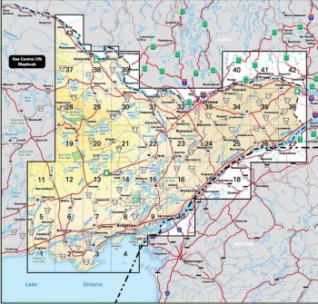
The maps in this book highlight the logging/bush road network, trail systems and recreation opportunities for Eastern Ontario. A unique feature of the maps is that all recreation activities are labelled, allowing for quick and easy referencing when researching a specific area. Included are 47 maps at a 1:150,000 scale and 3 city & park maps at 1:60,000 or 1:85,000 scales. No other source provides as much detail and accuracy on the road and trail networks of Eastern Ontario. |
|
 |
|
Also available: Other Backroad Mapbooks |
| Price and availability subject to change.
Shipping and applicable taxes extra. Questions about this product? Please e-mail us. This page last modified: February 24, 2011 |
| Travel in Ontario main page · Maps of Ontario main page |
| What's New · Home · Search · Books on Canada · Canadian Maps and Charts · Ordering · Contact Us |
©Federal Publications Inc., 1998 - 2011 425 University Avenue, Ste. 401, Toronto, Ontario, Canada M5G 1T6 Phone: (416) 860-1611 or toll-free 1-888-433-3782 · E-mail: info@fedpubs.com |