Federal Publications logo FEDERAL
PUBLICATIONS
INC.

Navigation Bar Checkout View Cart Contact Us Canadian Maps and Charts Books on Canada Home

Eastern Ontario Fishing Mapbook, 3rd Edition

Eastern Ontario Fishing Mapbook, 3rd Edition    
Format Spiral-bound
Catalogue No. 978-1-897225-78-3
Pages 208
Language English only
Price $27.95
  Add to Cart

Written by Jason Marleau.
Published by Mussio Ventures Ltd., 2011.

Description:

The 3rd edition of the Eastern Ontario Fishing Mapbook now includes the popular Kawartha Lakes. This edition has been expanded to include many new lakes and streams as well as countless other fishing tips. Now you can explore the best lakes and rivers in Eastern Ontario with the confidence of a good guide.

The coloured depth charts combined with the valuable information on such things as access, facilities, fishing tips and stocking will allow you to choose that ideal fishing hole. This information is invaluable to increase your success and is especially important to anglers visiting an Ontario fishing hotspot for the first time.

Features and Benefits:
  • Lake Charts: Contour map or depth chart provided for each lake. Each lake and stream comes with a map key and location indicator. This feature, along with the access or driving directions, will help guide you into the lake.
  • Road Features: Complete classified road systems, road names and more
  • Longitude and Latitude: for the GPS user
  • Reference Section: Comprehensive write up on Fishing, Access Info, Facilities, Stocking Info, and more.
Coverage are:

Eastern Ontario Fishing Mapkey

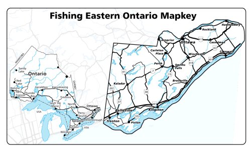
The area covered stretches as far west as Lake Simcoe and spans east to the Ottawa Valley. The northern border starts around Orillia past Bancroft to Renfrew, covering all the way south to Lake Ontario.

Eastern Ontario Fishing Mapbook, 3rd Edition provides detailed depth charts to the best lakes and water bodies found in Eastern Ontario:

 
  • Anstruther Lake
  • Apsley Lake
  • Balsam Lake
  • Bass Lake - Lindsay/Bobcaygeon
  • Bass Lake - Perth/Rideau
  • Bay of Quinte - Trenton to Northport
  • Bay of Quinte - North Channel
  • Beaver Lake - Kawarthas Highlands
  • Beaver Lake - Tweed
  • Belmont Lake
  • Bennett Lake
  • Big & Little Bald Lakes
  • Big Cedar Lake
  • Big Gull [Clarendon] Lake
  • Big Salmon Lake
  • Birch Lake
  • Black Donald Lake
  • Black Lake
  • Bob's Lake
  • Bottle Lake
  • Buck Lake
  • Buckshot Lake - Upper
  • Buckshot Lake
  • Buzzard Lake
  • Calabogie Lake
  • Cameron Lake
  • Canal Lake
  • Canoe Lake
  • Canonto [Lower Trout] Lake
  • Catachacoma Lake
  • Centennial Lake
  • Chandos Lake
  • Charleston Lake
  • Chemong Lake - Upper
  • Chemong Lake - Lower
  • Cherry Lake
  • Christie Lake
  • Clayton & Taylor Lakes
  • Clear Lake
  • Clydesdale Lake
  • Collins Lake
  • Consecon Lake
  • Constance Lake
  • Cook Lake
  • Copper Lake
  • Cordova Lake
  • Crab Lake
  • Cranberry Lake
  • Crosby Lake
  • Crotch Lake
  • Crow Lake
  • Crystal Lake
  • Dalhousie Lake
  • Dalrymple Lake
  • Depot Lake - 1st
  • Depot Lake - 2nd
  • Desert Lake
  • Devil Lake
  • Dicky Lake
  • Dog Lake
  • Dummer [White] Lake
  • Eagle Lake
  • Farren [Farrell] Lake
  • Fortescue Lake
  • Four Mile Lake
  • Gananoque Lake
  • Ganaraska River
  • Gold Lake
  • Gould Lake
  • Graham Lake
  • Grindstone Lake
  • Grippen Lake
  • Head Lake
  • Indian Lake
  • Jack Lake
  • Julian Lake
  • Kashawakamak Lake
  • Kasshabog Lake
  • Katchwanooka Lake
  • Kennebec Lake
  • Lake Couchiching - North
  • Lake Couchiching - South
  • Leggat Lake
  • Lake Opinicon
  • Lake St. John
  • Lake Simcoe
  • Lake Scugog
  • Lasswade Lake
  • Limerick Lake
  • Lingham Lake
  • Little Anstruther Lake
  • Little Clear Lake
  • Little Salmon Lake
  • Long Lake
  • Loughborough Lake - East Basin
  • Loughborough Lake - West Basin
  • Loon Call Lake
  • Lower Beverly Lake
  • Lower Buckhorn [Lovesick] Lake
  • Lower Rideau Lake
  • Lyndhurst Lake
  • Mackie Lake
  • Mazinaw Lake
  • McGee Lake
  • Mephisto Lake
  • Methuen Lake
  • Mississagagon Lake
  • Mississagua Lake
  • Mississippi Lake
  • Mitchell Lake
  • Moira Lake
  • Mosque Lake
  • Mosquito Lake
  • Mud Turtle Lake
  • Newboro Lake
  • Nogies Creek
  • Nogies Lake
  • Norcan Lake
  • Ottawa River - Arnprior
  • Ottawa River - Constance Bay
  • Ottawa River - Ottawa Hull
  • Ottawa River - Petrie Islands
  • Ottawa River - Rockland
  • Ottawa River - Wendover
  • Otonabee River
  • Otter Lake
  • Otty Lake
  • Patterson Lake
  • Percy Reach [Trent River]
  • Pike Lake
  • Pigeon Lake
  • Potspoon Lake
  • Red Horse Lake
  • Rice Lake
  • [Big] Rideau Lake
  • Robinson Lake
  • Round Lake
  • Salmon Lake
  • Sand [Davis] Lake
  • Sand [Westport] Lake
  • Sandy Lake - Harvey Township
  • Shabomeka [Buck] Lake
  • Shadow Lake
  • Sharbot Lake
  • Silver Lake - Coboconk
  • Silver Lake - Perth
  • Singleton Lake
  • Skootamatta Lake
  • South Lake
  • Spring Lake
  • St. Lawrence River
  • St. Ola Lake
  • Stoco Lake
  • Stoney Lake
  • Sturgeon Lake
  • Sydenham Lake
  • Tallan Lake
  • Tangamong & Whetstone Lakes
  • Thanet Lake
  • Thirty Island Lake
  • Turtle Lake
  • Twin Sisters Lake
  • Upper Beverly Lake
  • Upper Rideau Lake
  • Urbach Lake
  • Varty Lake
  • Victoria & West Victoria Lakes
  • Wellers Bay [Lake Ontario]
  • Wensley [Brule] Lake
  • Weslemkoon Lake
  • West Lake
  • White Lake - Calabogie
  • White Lake - Kinmount
  • Wolf Lake
  • Wolfe Lake
  • Wollaston Lake
  • Young Lake
Price and availability subject to change. Shipping and applicable taxes extra.
Questions about this product? Please e-mail us.
This page last modified: June 28, 2011

Outdoor Activities main page
What's New · Home · Search · Books on Canada · Canadian Maps and Charts · Ordering · Contact Us

©Federal Publications Inc., 1998 - 2011, 2000, 2001
425 University Avenue, Ste. 401, Toronto, Ontario, Canada M5G 1T6
Phone: (416) 860-1611 or toll-free 1-888-433-3782 · E-mail: info@fedpubs.com