Federal Publications logo FEDERAL
PUBLICATIONS
INC.

Navigation Bar Checkout View Cart Contact Us Canadian Maps and Charts Books on Canada Home

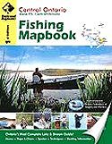
Central Ontario Fishing Mapbook, 1st Edition

Central Ontario Fishing Mapbook    
Format Spiral-bound
Catalogue No. 978-1-897225-16-5
Pages 144
Language English only
Price $25.95
  Add to Cart

Written by Trent Ernst.
Published by Mussio Ventures Ltd., 2008.

Description:

Welcome to the first edition of the Central Ontario Fishing Mapbook. This book is a combination of the former Haliburton and Muskoka region Fishing Ontario titles, and adds the popular Algonquin Park, Parry Sound and Renfrew areas. Anglers will also be pleased to see that the fishing series not only carries all the popular lakes, but now also covers the main rivers.

What makes the Fishing Mapbook series so unique is the fact that they combine those ever-popular depth charts or lake charts with detailed information on everything from access to facilities to fish stocking and techniques. This information can be used by everyone from the greenest angler to the most seasoned veteran. Covering over 150 lakes and streams with such detail you will quickly see why these guides remain the books of choice for locals and visitors alike.

Central Ontario Fishing Mapbook covers the new Zone 15 of the Freshwater Fishing Synopsis. This is a large area that includes Bracebridge, Huntsville and Parry Sound in the west, Algonquin Park, Haliburton and Bancroft in the centre, as well as Renfrew and Pembroke in the east. Needless to say, there is no shortage of great fishing holes in the area. Whether you are looking for those elusive brook or lake trout or prefer the ferocious attacks of bass or walleye, the breadth and variety of fish species is amazing. Another nice fact is that this area is set a little ways away from the urban sprawl. This means you can still find a few places that you can still call your own on opening day.

Features and Benefits:
  • 118 Lake Charts @ various scales, 6 River Maps @ various scales
  • Lake Charts: Contour map or depth chart provided for each lake. Each lake and stream comes with a map key and location indicator. This feature, along with the access or driving directions, will help guide you into the lake.
  • Road Features: Complete classified road systems, road names and more
  • Longitude and Latitude: for the GPS user
  • Reference Section: Comprehensive write up on Fishing, Access Info, Facilities, Stocking Info, and more.
Coverage area:

Central Ontario Fishing Mapkey

The editors at Backroad Mapbooks have consulted with the Federation of Anglers and Hunters, local writers and Island retailers to help refine the content. In addition to benefiting from many helpful eyes reviewing the content, readers can be assured the list covers most of the hot spots around Central Ontario.

Contains:
 
  • Ahmic Lake
  • Arrowhead Lakes
  • Aylen Lake
  • Baptiste Lake
  • Bark Lake
  • Bass Lake
  • Basshaunt Lake
  • Bella Lake
  • Bernard Lake
  • Big East Lake
  • Big Hawk Lake
  • Big Hoover Lake
  • Bigwind Lake
  • Blackstone Harbour
  • Blackstone Lake
  • Blue Hawk Lake
  • Bob Lake
  • Bonnie Lake
  • Booth Lake
  • Boshkung Lake
  • Buck Lake
  • Cache Lake
  • Camp Lake - Huntsville
  • Canisby Lake
  • Canoe Lake
  • Cedar Lake
  • Clear Lake - Parry Sound
  • Crosson Lake
  • Deer Lake - Sundridge
  • Dickie Lake
  • Dickson Lake
  • Doe Lakes
  • Drag Lake
  • Eagle Lake
  • Eagle Lake - Sundridge
  • Eels Lake
  • Elephant Lake
  • Esson (Otter) Lakes
  • Fairy Lake
  • Farquhar Lake
  • Fawn Lake
  • Fishog Lake
  • Fishtail Lake
  • French River (East)
  • French River (West)
  • Glamor (Big Bear) Lake
  • Gloucester Pool
  • Go Home River & Lake
  • Golden Lake
  • Gull Lake - Gravenhurst
  • Gull Lake - Minden
  • Haliburton Lake
  • Halls Lake
  • Havelock Lake
  • Head Lake
  • Healy Lake
  • Horseshoe Lake - Haliburton
  • Horseshoe Lake - Muskoka
  • Isabella Lake
  • Kabakwa (Peach) Lake
  • Kahshe Lake
  • Kamaniskeg Lake
  • Kapikog Lake
  • Kashagawigamog Lake
  • Kawagama Lake
  • Kelly Lake
  • Kennisis Lake
  • Koshlong Lake
  • Kushog Lake
  • Lake Cecebe
  • Lake Joseph
  • Lake Lavielle
  • Lake Louisa
  • Lake Muskoka
  • Lake of Bays
  • Lake Rosseau
  • Lake Vernon
  • Little Boshkung Lake
  • Little Hawk Lake
  • Little Lake Joseph
  • Loon (Dudmon) Lake - Haliburton
  • Madawaska River
  • Manitouwabing Lake
  • Maple (Ninatigo) Lake
  • Mary Lake
  • Mattawa River (East)
  • Mattawa River (West)
  • Miskwabi (Misquabinish) Lake
  • Moon River Bays
  • Moose Lake
  • Mountain Lake
  • Oblong Lake
  • Opeongo Lake
  • Orr Lake
  • Oxtongue Lake
  • Peninsula Lake
  • Percy (Pine) Lake
  • Prospect Lake
  • Raven Lake
  • Rebecca Lake
  • Red Pine Lake
  • Redstone Lake
  • Rideout Lake
  • Ril Lake
  • Round Lake
  • Salerno Lake
  • Sherborne (Trout) Lake
  • Shirley Lake
  • Silver Lake
  • Six Mile Lake
  • Skeleton Lake
  • Smoke Lake
  • Soyers Lake
  • Sparrow Lake
  • St. Nora Lake
  • Tea Lake - Matchedash Twn
  • Three Mile Lake
  • Twelve Mile Lake
  • Whitefish Lake
Price and availability subject to change. Shipping and applicable taxes extra.
Questions about this product? Please e-mail us.
This page last modified: February 22, 2012

Outdoor Activities main page
What's New · Home · Search · Books on Canada · Canadian Maps and Charts · Ordering · Contact Us

©Federal Publications Inc., 1998 - 2012, 2000, 2001
425 University Avenue, Ste. 401, Toronto, Ontario, Canada M5G 1T6
Phone: (416) 860-1611 or toll-free 1-888-433-3782 · E-mail: info@fedpubs.com