| FEDERAL PUBLICATIONS INC. |
| |
|
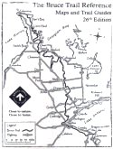
The Bruce Trail Reference, Edition 26: Trail Guide and Maps |
 |
||
| Format | Looseleaf Binder | |
| Catalogue No. | 978-0-9780377-5-8 | |
| Pages | Approx. 120 | |
| Language | English only | |
| Price | $36.95 | |
| Published by the Bruce Trail Association, 2010. Description: |
| The well-known Bruce Trail
Guide has been updated for 2010. This is the definitive resource for the Bruce
Trail hiker. Updated maps and content will help keep you on the right path.
The Bruce Trail Reference is beautifully illustrated with colour
photographs throughout. This is a comprehensive guide to the Bruce Trail from Queenston Heights to Tobermory. Each section contains 1:50,000 scale topographic maps in full-colour, descriptions and distances of individual trails, plus camping and parking information. The convenient binder format makes it easy to remove the required sections to take with you on your hike. Contents:
|
| Price and availability subject to change.
Shipping and applicable taxes extra. Questions about this product? Please e-mail us. This page last modified: July 6, 2010 |
| Hiking main page · Travel in Ontario main page |
| What's New · Home · Search · Books on Canada · Canadian Maps and Charts · Ordering · E-mail Us |
©Federal Publications Inc., 1998 - 2010 425 University Avenue, Ste. 401, Toronto, Ontario, Canada M5G 1T6 Phone: (416) 860-1611 or toll-free 1-888-433-3782 · E-mail: info@fedpubs.com |