| FEDERAL PUBLICATIONS INC. |
| |
|
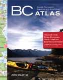
BC Coastal Recreation, Kayaking and Small Boat Atlas Volume 1: British Columbia’s South Coast and East Vancouver Island |
 |
||
| Format | Spiral-bound (11 1/2" x 14 1/8" x 1/2") | |
| Catalogue No. | 978-1-55285-864-6 | |
| Pages | 57 | |
| Language | English only | |
| Price | $40.00 | |
| Not available for purchase at this time. |
| Written by John Kimantas. Published by Whitecap Books, 2007. Description: |
| BC Coastal Recreation, Kayaking and Small Boat
Atlas: Volume 1: British Columbia’s South Coast and East Vancouver
Island provides an overview of British Columbia’s south coast from
Victoria to Port McNeill, and from Howe Sound to the Broughton Islands.
Numerous land-based features are identified, among them campsites and launch
locations. This portable water-resistant book is ideal for kayakers who want a
detailed overview in a format much easier to use than bulky charts.
Recreational boaters will also appreciate the convenience of these
maps. Other titles by John Kimantas: BC Coastal Recreation, Kayaking and Small Boat Atlas Volume 2: West Vancouver Island |
| Price and availability subject to change.
Shipping and applicable taxes extra. Questions about this product? Please e-mail us. This page last modified: May 17, 2011 |
| Boating main page · Paddling main page |
| What's New · Home · Search · Books on Canada · Canadian Maps and Charts · Ordering · Contact Us |
©Federal Publications Inc., 1998 - 2011 425 University Avenue, Ste. 401, Toronto, Ontario, Canada M5G 1T6 Phone: (416) 860-1611 or toll-free 1-888-433-3782 · E-mail: info@fedpubs.com |