| FEDERAL PUBLICATIONS INC. |
| |
|
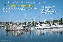
Richardsons' Chartbook and Cruising Guide: Lake Superior, including De Tour Passage, St. Mary's River and Soo Locks, Keweenaw Waterway, Apostle Islands and Isle Royale - 4th Edition |
 |
||
| Format | Spiral-bound | |
| Catalogue No. | 0-932647-27-8 | |
| Pages | 114 | |
| Language | English only | |
| Price | $84.95 | |
Published by Edgewater Marine Industries, LLC, 2011. Description: |
To increase the usefulness of this volume, information concerning marinas, repair facilities, yachtclubs, parks and launch ramps have been added. Each facility listing contains a summary of the services offered. Harbour photos aid the boater when entering channels. Supplementary information includes (among other pertinent data): radio communications, radio navigation, Rules of the Road, weather data, distress signals and Coast Guard facilities. |
| Price and availability subject to change.
Shipping and applicable taxes extra. Questions about this product? Please e-mail us. This page last modified: June 21, 2011 |
| Boating main page · Lake Superior Chart Index |
| What's New · Home · Search · Books on Canada · Canadian Maps and Charts · Ordering · Contact Us |
©Federal Publications Inc., 1998 - 2011 425 University Avenue, Ste. 401, Toronto, Ontario, Canada M5G 1T6 Phone: (416) 860-1611 or toll-free 1-888-433-3782 · E-mail: info@fedpubs.com |