| FEDERAL PUBLICATIONS INC. |
| |
|
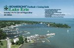
Richardsons' Chartbook and Cruising Guide: Lake Erie, including Lake St. Clair and Niagara River - 6th Edition |
 |
||
| Format | Spiral-bound | |
| Catalogue No. | 0-932647-25-1 | |
| Pages | 118 | |
| Language | English only | |
| Price | $94.95 | |
Published by Richardsons' Marine Publishing, 2005. Description: |
| Covers all of Lake Erie,
including Lake St. Clair and Niagara River. The charts contained in this volume have been reproduced from the latest available government charts (when the edition went to print). Most charts appear in the same scale as the originals. The charts have been formatted into a convenient 12" x 18" format, and spiral-bound to provide a convenient and economic cruising tool. To further the usefulness of this volume, information concerning marinas, repair facilities, yacht clubs, parks and launch ramps have been added. Each facility listing contains a summary of the services offered. Harbour photos aid the boater when entering channels. Supplementary information includes (among other pertinent data): radio communications, radio navigation, Rules of the Road, weather data, distress signals and Coast Guard facilities. |
| Price and availability subject to change.
Shipping and applicable taxes extra. Questions about this product? Please e-mail us. This page last modified: April 26, 2011 |
| Boating main page· Lake Erie Chart Index |
| What's New · Home · Search · Books on Canada · Canadian Maps and Charts · Ordering · Contact Us |
©Federal Publications Inc., 1998 - 2011 425 University Avenue, Ste. 401, Toronto, Ontario, Canada M5G 1T6 Phone: (416) 860-1611 or toll-free 1-888-433-3782 · E-mail: info@fedpubs.com |