| FEDERAL PUBLICATIONS INC. |
| |
|
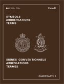
Chart No. 1: Symbols, Abbreviations, and Terms Used on Nautical Charts2012 Edition |
 |
||
| Format | Softcover | |
| Catalogue No. | 1 | |
| Pages | 130 | |
| Language | Bilingual | |
| Price | $6.00 | |
Published by the Canadian Hydrographic Service, 2012. Description: |
| Chart No. 1 contains the Symbols, Abbreviations and Terms used on
navigation charts published by the Canadian Hydrographic Service, and is based
upon the "Chart Specifications of the International Hydrographic Organization".
Chart No. 1 is vital reference for understanding
charts. Contains: General:
|
| Price and availability subject to change.
Shipping and applicable taxes extra. Questions about this product? Please e-mail us. This page last modified: May 10, 2012 |
| Boating main page · Nautical Charts main page |
| What's New · Home · Search · Books on Canada · Canadian Maps and Charts · Ordering · Contact Us |
©Federal Publications Inc., 1998 - 2016 425 University Avenue, Ste. 401, Toronto, Ontario, Canada M5G 1T6 Phone: (416) 860-1611 or toll-free 1-888-433-3782 · E-mail: info@fedpubs.com |