| FEDERAL PUBLICATIONS INC. |
| |
|
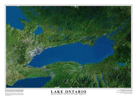
Lake Ontario Satellite Poster |
| We regret, this item is no longer in print
and is not expected to be reprinted. |
| Format | Laminated | OR | Format | Paper | |
| Catalogue No. | WSL-L.ONTARIO | Catalogue No. | WSP-L.ONTARIO | ||
| Price | $24.95 | Price | $16.95 | ||
| Language | Bilingual | Language | Bilingual | ||
| Not Available | Not Available |
| Published by Worldsat. Description: |
| This remarkable natural coloured view of Lake Ontario and
surrounding regions was generated from eight Landsat satellite images mosaicked
together,and enhanced with a digital elevation model to provide a sense of 3-D
relief. The Landsat satellites orbit the earth at an altitude of 700 kilometers
(450 miles). The portrait of Lake Ontario extends from Georgian Bay in the north-west, across cottage country, to the Thousand Islands area, and from Long Point in the middle of the North Shore of Lake Erie, through the Fringe Lakes in Upstate New York, ending at the Appalachian Mountains. Size: 36" x 24" |
 |
Price and availability subject to change. Shipping and applicable taxes extra. Questions about anything on this page? Please e-mail us. This page last modified: May 29, 2008 |
| Ontario Maps main page |
| What's New · Home · Search · Books on Canada · Canadian Maps and Charts · Ordering · E-mail Us |
©Federal Publications Inc., 1998 - 2008 165 University Avenue, Toronto, Ontario, Canada M5H 3B8 Phone: (416) 860-1611 or toll-free 1-888-433-3782 · E-mail: info@fedpubs.com |