| FEDERAL PUBLICATIONS INC. |
| |
|
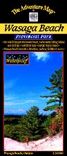
Wasaga Beach Provincial ParkThe Adventure Map® |
 |
||
| Format | Waterproof folded map | |
| Catalogue No. | 0-929140-44-3 | |
| Scale | 1:20,000 | |
| Language | English only | |
| Price | $8.95 | |
| Published by Chrismar Mapping Services, 2003. Description: |
| The Wasaga Beach Provincial Park map details
the world's longest freshwater beach, with backcountry hiking, biking, and ski
trails. Wasaga Beach Provincial Park is a 1529 hectare Recreation-class Provincial Park providing a variety of special attractions for visitors. For those who seek some fresh air and exercise, the beach offers excellent swimming, hiking, biking, cross-country skiing, and snowshoeing. For history buffs, the Nancy Island Historic Site tells the story of the War of 1812 warship "Nancy". Nature seekers have 14 kilometres of white sand beaches and over 1100 hectares of forested dune area to explore, including the largest parabolic sand dunes in Ontario, animals like deer and the rare Eastern Hognose Snake, lush forests of white birch, red maple, white pine and red oak, and lots of beautiful wildflowers. This 1:20,000 scale map has unprecedented detail, and includes beach access points, hiking trails, town details and features including road names, canoe access points, plus many other features. The back side is full of helpful info and beautiful colour photographs about the park history, animals, fish and birds, hiking trails, other attractions, contact info and much more. This map has been adopted by the Park as the standard reference for the area. The Adventure Map® is specifically designed for outdoor adventurers such as hikers, backpackers, and paddling enthusiasts who need an accurate, up-to-date, rugged map to get them into and safely back from the wilderness. The Adventure Map® is compact (most measure 18" x 24"/45 x 61cm or less), easy to read, and easy to fold. The maps are also waterproof, printed on specially-made, extra tough, waterproof plastic. The flip side of each sheet is filled with colour photos and important information about the area including natural and human history, local regulations, outdoor tips, safety concerns, addresses, useful phone numbers and more. |
Price and availability subject to change. Shipping and applicable taxes extra. Questions about anything on this page? Please e-mail us. This page last modified: August 6, 2008 |
| Ontario Parks Maps main page |
| What's New · Home · Search · Books on Canada · Canadian Maps and Charts · Ordering · Contact Us |
©Federal Publications Inc., 1998 - 2011 425 University Avenue, Ste. 401, Toronto, Ontario, Canada M5G 1T6 Phone: (416) 860-1611 or toll-free 1-888-433-3782 · E-mail: info@fedpubs.com |