| FEDERAL PUBLICATIONS INC. |
| |
|
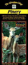
Pinery Provincial ParkThe Adventure Map® |
 |
||
| Format | Waterproof folded map | |
| Catalogue No. | 0-929140-21-4 | |
| Scale | 1:20,000 | |
| Language | English only | |
| Price | $6.95 | |
| Published by Chrismar Mapping Services, 1998. Description: |
| Located on the Ontario shore of Lake Huron just 60
km north of Sarnia, the rolling dunes and unusual oak savanna forests of Pinery
create a popular destination for hiking, biking, paddling, and camping. It's
also a great place for animal and birdwatching. For example, thousands of
Tundra Swans return to this area each spring on their way north. This 1:20,000 scale map shows all trails, lakes, streams, wetlands, open areas, extraordinary contour detail and even individual campsites. The map includes informative text and colour photographs about the natural and human history of the area, trail descriptions, canoe routes, safety tips, contact info, and more. This map has been adopted as the official map of the park. The Adventure Map® is specifically designed for outdoor adventurers such as hikers, backpackers, and paddling enthusiasts who need an accurate, up-to-date, rugged map to get them into and safely back from the wilderness. The Adventure Map® is compact (most measure 18" x 24"/45 x 61cm or less), easy to read, and easy to fold. The maps are also waterproof, printed on specially-made, extra tough, waterproof plastic. |
| Price and availability subject to change.
Shipping and applicable taxes extra. Questions about anything on this page? Please e-mail us. This page last modified: August 6, 2008 |
| Ontario Parks Maps main page |
| What's New · Home · Search · Books on Canada · Canadian Maps and Charts · Ordering · Contact Us |
©Federal Publications Inc., 1998 - 2016 425 University Avenue, Ste. 401, Toronto, Ontario, Canada M5G 1T6 Phone: (416) 860-1611 or toll-free 1-888-433-3782 · E-mail: info@fedpubs.com |