| FEDERAL PUBLICATIONS INC. |
| |
|
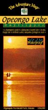
Opeongo Lake - Algonquin Provincial ParkThe Adventure Map® |
 |
||
| Format | Waterproof folded map | |
| Catalogue No. | 0-929140-55-9 | |
| Scale | 1:50,000 | |
| Language | English only | |
| Price | $6.95 | |
| Published by Chrismar Mapping Services, 2006. Description: |
| Opeongo is the largest lake in Algonquin Park, and
plenty big enough for a week or more of canoe tripping. Other lakes on this
1:50,000 scale map include Happy Isle, Redrock, Proulx, Wright and Bonfield, as
well as all the campsites, portages, facilities, fish species and other
features you'd expect from one of our maps. The routes of two of the first explorers through the area are also indicated. The maps also features colour photos and text about the area, including several recommended trips in the area. The Adventure Map® is specifically designed for outdoor adventurers such as hikers, backpackers, and paddling enthusiasts who need an accurate, up-to-date, rugged map to get them into and safely back from the wilderness. The Adventure Map® is compact (most measure 18" x 24"/45 x 61cm or less), easy to read, and easy to fold. The maps are also waterproof, printed on specially-made, extra tough, waterproof plastic. |
| Price and availability subject to change.
Shipping and applicable taxes extra. Questions about anything on this page? Please e-mail us. This page last modified: February 2, 2009 |
| Algonquin Park main page |
| What's New · Home · Search · Books on Canada · Canadian Maps and Charts · Ordering · E-mail Us |
©Federal Publications Inc., 1998 - 2016 425 University Avenue, Ste. 401, Toronto, Ontario, Canada M5G 1T6 Phone: (416) 860-1611 or toll-free 1-888-433-3782 · E-mail: info@fedpubs.com |