| FEDERAL PUBLICATIONS INC. |
| |
|
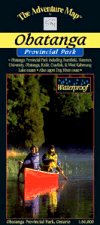
Obatanga Provincial ParkThe Adventure Map® |
 |
||
| Format | Waterproof folded map | |
| Catalogue No. | 0-929140-75-3 | |
| Scale | 1:50,000 | |
| Language | English only | |
| Price | $8.95 | |
| Published by Chrismar Mapping Services, 2000. Description: |
| Obatanga is a charming medium-sized park straddling
the Trans-Canada Hwy 17 north of Wawa. Still relatively unknown, it is an area
of superb paddling and hiking terrain for both novices, families and
veterans. This 1:50,000 scale map covers the entire park plus an equal area outside it (about 310km2 in total) including the top end of Dog River, numerous paddling lakes and streams, as well as hiking trails and other park facilities. Major lakes include University, Hammer, Obatanga, Burnfield, Knife, Heart, Crayfish, West Kabenung lakes plus Knife and Dog Rivers. This map has been adopted as the official map of Obatanga Provincial Park. The Adventure Map® is specifically designed for outdoor adventurers such as hikers, backpackers, and paddling enthusiasts who need an accurate, up-to-date, rugged map to get them into and safely back from the wilderness. The Adventure Map® is compact (most measure 18" x 24"/45 x 61cm or less), easy to read, and easy to fold. The maps are also waterproof, printed on specially-made, extra tough, waterproof plastic. |
| Price and availability subject to change.
Shipping and applicable taxes extra. Questions about anything on this page? Please e-mail us. This page last modified: August 6, 2008 |
| Ontario Parks Maps main page |
| What's New · Home · Search · Books on Canada · Canadian Maps and Charts · Ordering · Contact Us |
©Federal Publications Inc., 1998 - 2011 425 University Avenue, Ste. 401, Toronto, Ontario, Canada M5G 1T6 Phone: (416) 860-1611 or toll-free 1-888-433-3782 · E-mail: info@fedpubs.com |