| FEDERAL PUBLICATIONS INC. |
| |
|
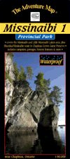
Missinaibi 1 - Missinaibi Lakes AreaThe Adventure Map® |
 |
||
| Format | Waterproof folded map | |
| Catalogue No. | 0-929140-91-5 | |
| Scale | 1:50,000 | |
| Language | English only | |
| Price | $14.95 | |
| Published by Chrismar Mapping Services, 2008. Description: |
| Most serious paddlers have heard of the Missinaibi
River – the longest unbroken stretch of paddling river in Ontario –
but that's not what this map is about. This map is about the lakes and
headwaters that eventually become the river, and in many ways this area is much
better. There are two major lakes on the map – Missinaibi Lake and Little Missinaibi Lake. The former has main arms over 43 km long with numerous bays and islands. Little Missinaibi Lake is quite different than her bigger relative – narrow and convoluted like a pretzel – but with equally fascinating cliffs, old-growth trees and pictograph sites. A very challenging whitewater river joins the two, with an alternative flatwater route with portages preferred by most. There is also a small, but nicely situated, campground on Missinaibi Lake, at the end of the access road from Chapleau. The map also includes some fine paddling area outside the Park, in particular the Shumka area that makes a great wild paddling loop from "big and little Miss" south and west to the railway and back. The railway is key because it means you can access the area from as far away as Sudbury. No need to drive – just throw your canoe and gear on the train and get off and on where you want. The map also features the Chapleau Crown Game Preserve – the largest of its kind in the world. Wildlife is not hunted or trapped here so you're likely to see more than the usual big moose, bald eagles, osprey, black bear, and more. The Adventure Map® is specifically designed for outdoor adventurers such as hikers, backpackers, and paddling enthusiasts who need an accurate, up-to-date, rugged map to get them into and safely back from the wilderness. The Adventure Map® is compact (most measure 18" x 24"/45 x 61cm or less), easy to read, and easy to fold. The maps are also waterproof, printed on specially-made, extra tough, waterproof plastic. |
| Price and availability subject to change.
Shipping and applicable taxes extra. Questions about anything on this page? Please e-mail us. This page last modified: April 19, 2011 |
| Ontario Parks Maps main page |
| What's New · Home · Search · Books on Canada · Canadian Maps and Charts · Ordering · Contact Us |
©Federal Publications Inc., 1998 - 2016 425 University Avenue, Ste. 401, Toronto, Ontario, Canada M5G 1T6 Phone: (416) 860-1611 or toll-free 1-888-433-3782 · E-mail: info@fedpubs.com |