| FEDERAL PUBLICATIONS INC. |
| |
|
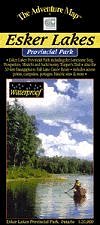
Esker Lakes Provincial ParkThe Adventure Map® |
 |
||
| Format | Waterproof folded map | |
| Catalogue No. | 0-929140-82-6 | |
| Scale | 1:20,000 | |
| Language | English only | |
| Price | $8.95 | |
| Published by Chrismar Mapping Services, 2002. Description: |
| This little-known park situated in the sandy forests
near Kirkland Lake, Ontario is almost never crowded, so if you're looking for a
quiet place to hike on trails up to 20 kilometres in length, or paddle on
numerous wilderness lakes separated by short portages (longest is approximately
300 metres), then this the place for you. This large-scale 1:20,000 scale topographic map shows trails, lakes, streams, wetlands, open areas, extraordinary contour detail and much more. The map includes informative text and colour photographs about the natural and human history of the area, trail descriptions, canoe routes, safety tips, contact info, and more. This map has been adopted as the official map of the park. The Adventure Map® is specifically designed for outdoor adventurers such as hikers, backpackers, and paddling enthusiasts who need an accurate, up-to-date, rugged map to get them into and safely back from the wilderness. The Adventure Map® is compact (most measure 18" x 24"/45 x 61cm or less), easy to read, and easy to fold. The maps are also waterproof, printed on specially-made, extra tough, waterproof plastic. |
| Price and availability subject to change.
Shipping and applicable taxes extra. Questions about anything on this page? Please e-mail us. This page last modified: April 19, 2011 |
| Ontario Parks Maps main page |
| What's New · Home · Search · Books on Canada · Canadian Maps and Charts · Ordering · Contact Us |
©Federal Publications Inc., 1998 - 2011 425 University Avenue, Ste. 401, Toronto, Ontario, Canada M5G 1T6 Phone: (416) 860-1611 or toll-free 1-888-433-3782 · E-mail: info@fedpubs.com |