| FEDERAL PUBLICATIONS INC. |
| |
|
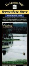
Bonnechere River Provincial ParkThe Adventure Map® |
 |
||
| Format | Waterproof folded map | |
| Catalogue No. | 0-929140-35-4 | |
| Scale | 1: 25 000 | |
| Language | English only | |
| Price | $8.95 | |
| Published by Chrismar Mapping Services, 2004. Description: |
| The "Little Bonnechere" as this section is
traditionally called, is one of eastern Ontario's best canoeing rivers, with a
fine combination of natural beauty, moving water, small lakes and human
history. Covering the stretch from Basin Depot within Algonquin Provincial Park
east to Round Lake, the Bonnechere River Provincial Park Adventure
Map® includes all access points, portages, campsites and services.
The flip side of the map is filled with colour photos and important information about the area including natural and human history, local regulations, outdoor tips, safety concerns, addresses, useful phone numbers and more. The Adventure Map® is specifically designed for outdoor adventurers such as hikers, backpackers, and paddling enthusiasts who need an accurate, up-to-date, rugged map to get them into and safely back from the wilderness. The Adventure Map® is compact (most measure 18" x 24"/45 x 61cm or less), easy to read, and easy to fold. The maps are also waterproof, printed on specially-made, extra tough, waterproof plastic. |
| Price and availability subject to change.
Shipping and applicable taxes extra. Questions about anything on this page? Please e-mail us. This page last modified: April 19, 2011 |
| Ontario Parks Maps main page |
| What's New · Home · Search · Books on Canada · Canadian Maps and Charts · Ordering · Contact Us |
©Federal Publications Inc., 1998 - 2011 425 University Avenue, Ste. 401, Toronto, Ontario, Canada M5G 1T6 Phone: (416) 860-1611 or toll-free 1-888-433-3782 · E-mail: info@fedpubs.com |