The importance of good graphical representation of the topography when sailing in the Caribbean is essential. Well-marked rivers, towns and street plans all help to give a clear overall view of the shoreside facilities of the islands.
Caribbean Yachting Charts |
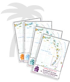
| Caribbean Yachting Charts are especially designed with the
requirements of the yachtsman in mind. Fine contours and easy-to-distinguish
color graduations of the depth line -- turquoise for coral reefs, red for the 2
meter line and blue for the 5 meter areas -- characterize the Caribbean
Yachting Charts. Presented in a handy, user-friendly size (23 1/2" x 16
1/2"), a thick plastic envelope protects the charts, enabling them to be easily
stored. The importance of good graphical representation of the topography when sailing in the Caribbean is essential. Well-marked rivers, towns and street plans all help to give a clear overall view of the shoreside facilities of the islands. |
|
| Red numbers waypoints with coordinates based on WGS 84 enable yachtsmen to navigate using their GPS instruments. Heights and depths are given in the internationally accepted format of meters. All area charts have the same scale (1:90,000, with passage charts of 1:500,000). Large-scale approaches and land contour markings simplify the entrance into anchorages. |
| Price and availability subject to change.
Shipping and applicable taxes extra. Questions about this product? Please e-mail us. This page last modified: December 5, 2006 |
| Nautical Charts for outside Canada main page |
| What's New · Home · Search · Books on Canada · Canadian Maps and Charts · Ordering · E-mail Us |
©Federal Publications Inc., 1998 - 2016 165 University Avenue, Toronto, Ontario, Canada M5H 3B8 Phone: (416) 860-1611 or toll-free 1-888-433-3782 · E-mail: info@fedpubs.com |
