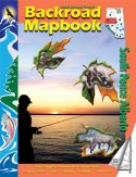
The South Peace Alberta Backroad Mapbook covers a sprawling
area that encompasses mountains, prairies, and miles upon miles of boreal
forest. There are relatively few settlements in the area - for people looking
to get away from it all, it is not all that hard to find a place to call your
own. Anglers and hunters will find this region an absolute paradise. Not only
is Lesser Slave Lake the best place in Alberta to fish for walleye, there are a
number of other outstanding lakes as well. Some of Canada's best rainbow trout
fishing lakes are in this region, and stream fishers will be delighted to know
that there are some fine creeks and rivers, especially near the mountains.
Hunters will be astounded with the number and variety of wildlife in many areas
of the South Peace.
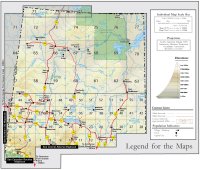
The reference section includes information on lake
and stream fishing, paddling routes, multi-use trails (hiking/biking/ATV),
wilderness camping (parks and conservation areas), and winter recreation. The
maps highlight the logging/bush road networks, trail systems and recreation
opportunities for South Peace Alberta. Whether fishing, paddling or hiking, the
South Peace Alberta Backroad Mapbook is much more than a set of maps -
it is an explorer's guide.
Written by Trent Ernst. Published by Mussio
Ventures Ltd., 2004. |