| FEDERAL PUBLICATIONS INC. |
| |
|
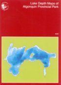
Lake Depth Maps of Algonquin Provincial Park |
 |
||
| Format | Softcover | |
| Catalogue No. | 1-895709-85-7 | |
| Pages | 31 | |
| Language | English only | |
| Price | $12.95 | |
Published by The Friends of Algonquin Park, 2003. Description: |
| Lake Depth Maps of Algonquin Provincial Park contains
colour maps of 23 lakes showing depth contours as well as describing other key
lake characteristics such as fish species present, maximum depth, and other
interesting lake features and historical facts. Includes: |
|
|
| Price and availability subject to change.
Shipping and applicable taxes extra. Questions about this product? Please e-mail us. This page last modified: May 4, 2004 |
| Algonquin Provincial Park page · Outdoor Activities main page · Recreational Maps |
| What's New · Home · Search · Books on Canada · Canadian Maps and Charts · Ordering · E-mail Us |
©Federal Publications Inc., 1998 - 2016 425 University Avenue, Ste. 401, Toronto, Ontario, Canada M5G 1T6 Phone: (416) 860-1611 or toll-free 1-888-433-3782 · E-mail: info@fedpubs.com |