| FEDERAL PUBLICATIONS INC. |
| |
|
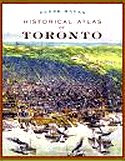
Historical Atlas of Toronto |
 |
||
| Format | Softcover | |
| Catalogue No. | 978-1-55365-497-1 | |
| Pages | 192 | |
| Language | English only | |
| Price | $34.95 | |
Written by Derek Hayes. Published by Douglas & McIntrye Ltd., 2008. First paperback edition published 2009. Description: |
| In just two centuries, Toronto has grown from a far-flung
outpost of the British Empire to a world-class city, the largest in
Canada. Lavishly illustrated with over three hundred maps, the Historical Atlas of Toronto charts the city's evolution from a Native village, to a French trading fort, to York, the capital of Upper Canada, and finally to Toronto, Canada's largest and most diverse metropolis. This book is the first to illustrate Toronto's history through contemporary maps, drawn at the time to record, promote or illustrate major events. Through these maps renowned map historian Derek Hayes reveals the critical roles that railways, streetcars, subways, and even the Canadian National Exhibition played in Toronto's explosive growth. Archival photographs and ephemera, along with an engrossing text, complement the maps. Historical Atlas of Toronto covers all of today's Greater Toronto Area, from Mississauga in the west to Oshawa in the east. Among its treasures are:
"A sure winner for anyone who loves art books, history, or maps. It's hard to imagine anyone who could resist getting happily lost on those glorious roads into our past." – The Toronto Star |
| Price and availability subject to change.
Shipping and applicable taxes extra. Questions about this product? Please e-mail us. This page last modified: September 28, 2009 |
| Geography main page · History main page |
| What's New · Home · Search · Books on Canada · Canadian Maps and Charts · Ordering · Contact Us |
©Federal Publications Inc., 1998 - 2011 425 University Avenue, Ste. 401, Toronto, Ontario, Canada M5G 1T6 Phone: (416) 860-1611 or toll-free 1-888-433-3782 · E-mail: info@fedpubs.com |