Navigation Bar E-mail Us Maps Publications Search Home

Canada Recreation Atlas

The Canada Recreation Atlas is a compilation of the provincial recreation maps produced by MapArt. It features full-colour maps covering all of Canada, including inset maps of 51 major cities. In addition to the maps, the Atlas includes:
  • Gazetteer of over 11,000 place names, creeks, rivers, lakes, inlets, bays and islands
  • Popular tourist attractions for each province
  • Listing of campgrounds, including private campgrounds, for each province, detailing the facilities and amenities offered
  • Provincial and National Park locations, with listings of available services and telephone contact numbers
  • Conservation Area locations, with listings of available services and telephone contact numbers
  • Highlighted canoe routes
  • Listing of ski resorts and golf courses nationwide, with telephone contact numbers
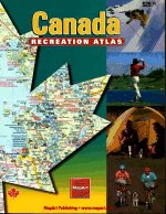
Canada Recreation Atlas
Jam-packed with information about fun things to do and places to go, the Canada Recreation Atlas is a great companion for any traveller.
Published by Peter Heiler Ltd., 2000.
1-55198-014-2 $29.95

Price and availability subject to change. Shipping and applicable taxes extra.
Questions about this product? Please e-mail us.
Last modified: October 4, 2000

Geography main page · Maps of Canada main page
What's New · Home · Search · Books on Canada · Canadian Maps and Charts · Ordering · E-mail Us

©Federal Publications Inc., 1998 - 2016
165 University Avenue, Toronto, Ontario, Canada M5H 3B8
Phone: (416) 860-1611 or toll-free 1-888-433-3782 · E-mail: info@fedpubs.com