Canada: A Land of Superlatives Poster |
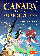
| Canada: A Land of Superlatives is a colourful double sided poster map featuring Canadian firsts in geography, communications, culture and sport. Find where Canada's largest puffin colony lives, and learn where five-pin bowling was invented! From coast to coast, Canada is a nation rich in achievement and potential. One side of the poster map features a stunning map of Canada derived from satellite images. Smaller map inserts feature Canada in terms of geological history, from the formation of earth, then the continents, the ice age and human migration to the Americas 40,000 years ago. Reflected on the second side of the poster map are superlatives: the biggest, highest, longest and first events. These events are detailed in text with accompanying graphics, pictures and charts. | |
Produced jointly between Canadian Geographic, the magazine of the Royal Canadian Geographical Society, and the National Atlas Information Service of the Department of Natural Resources Canada. Published by Natural Resources Canada, 1995. |
| Catalogue No. | MCR1401 |
| Price | $9.95 |
| Format | Folded poster |
| Pages | N/A |
| Language | English; Aussi disponible en français |
| Price and availability subject to change.
Shipping and applicable taxes extra. Questions about this product? Please e-mail us. This page last modified: August 4, 2000 |
| Canada main page · Maps of Canada main page |
| What's New · Home · Search · Books on Canada · Canadian Maps and Charts · Ordering · E-mail Us |
©Federal Publications Inc., 1998 - 2016 165 University Avenue, Toronto, Ontario, Canada M5H 3B8 Phone: (416) 860-1611 or toll-free 1-888-433-3782 · E-mail: info@fedpubs.com |