| FEDERAL PUBLICATIONS INC. |
| |
|
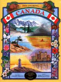
Discovering Canada |
 |
||
| Format | Softcover | |
| Catalogue No. | 0-19-541487-X | |
| Pages | 64 | |
| Language | English only | |
| Price | $21.25 | |
Written by Marlene Gutsole and Reginald Gutsole. Published by Oxford University Press, 2000. Description: |
| Discovering Canada introduces the young
reader to the second largest country in the world: Canada. It provides an
understanding of what Canada is by taking children on a journey across the
country, exploring the distinguishing characteristics of the provinces and
territories. Children, aged 9-12, are introduced to political maps and basic
geographic terms such as direction, latitude and longitude. Colourful maps,
illustrations and photographs combine to give young readers snapshots of the
many regions that make up this vast country. Contents: 1. What is Canada? 2. Directions 3. Latitude and Longitude 4. Political Map 5. Landforms 6. Physical Regions 7. Great Lakes - St. Lawrence Seaway 8. Energy 9. Trade 10. Newfoundland 11. Prince Edward Island 12. Nova Scotia 13. New Brunswick 14. Canada at a Glance 15. Quebec 16. Ontario 17. Ontario 18. Toronto 19. Manitoba 20. Saskatchewan 21. Alberta 22. British Columbia 23. Yukon 24. Northwest Territories 25. Nunavut 26. Faces of Canada Discovering Canada is part of Oxford's Discovery Series. The Discovery Series is dedicated to helping young people (ages 10 - 14) discover life in a variety of environments around the world, either contemporary or historical. Series editor: J. Bradley Cruxton. |
| Price and availability subject to change.
Shipping and applicable taxes extra. Questions about this product? Please e-mail us. This page last modified: November 30, 2007 |
| Canada main page · Geography main page |
| What's New · Home · Search · Books on Canada · Canadian Maps and Charts · Ordering · Contact Us |
©Federal Publications Inc., 1998 - 2011 425 University Avenue, Ste. 401, Toronto, Ontario, Canada M5G 1T6 Phone: (416) 860-1611 or toll-free 1-888-433-3782 · E-mail: info@fedpubs.com |