| FEDERAL PUBLICATIONS INC. |
| |
|
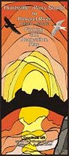
Parry Sound-Huntsville to Port Loring Fishing & Recreation Map |
 |
||
| Format | Waterproof folded map | |
| Catalogue No. | CGIS5 | |
| Scale | 1:361,000 | |
| Language | English only | |
| Price | $14.95 | |
| Published by Coordinate GIS, 2006. Description: |
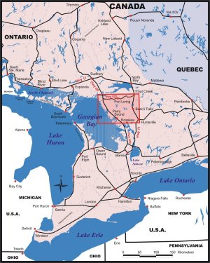
| Parry Sound-Huntsville to Port Loring Fishing & Recreation
Map is a full-colour, waterproof map at a scale of 1:361,000. It comes
pre-folded, and unfolds to 27.5" x 40". The map covers the region from just
south of Huntsville and north on Hwy 11 to Trout Creek in the east. The western
edge is south of Parry Sound to Pickerel River at the north end. The map shows:
|
 |
| Price and availability subject to change.
Shipping and applicable taxes extra. Questions about anything on this page? Please e-mail us. This page last modified: May 6, 2010 |
| Outdoor Activities main page · Recreation Maps main page |
| What's New · Home · Search · Books on Canada · Canadian Maps and Charts · Ordering · E-mail Us |
©Federal Publications Inc., 1998 - 2010 425 University Avenue, Ste. 401, Toronto, Ontario, Canada M5G 1T6 Phone: (416) 860-1611 or toll-free 1-888-433-3782 · E-mail: info@fedpubs.com |