General Nautical Charts of Atlantic Canada |
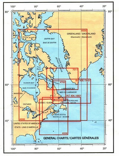
Looking for general nautical charts of Atlantic Canada? See below for an index to charts produced by Canadian Hydrographic Service - detailed information is available by clicking on an area of the map.If you do not see what you are looking for, please feel free to ask us. |
| Price and availability subject to change.
Shipping and applicable taxes extra. Questions about anything on this page? Please e-mail us. Last modified: June 11, 2001 |
| Index: Atlantic Coast |
| What's New · Home · Search · Books on Canada · Canadian Maps and Charts · Ordering · E-mail Us |
©Federal Publications Inc., 1998 - 2016 165 University Avenue, Toronto, Ontario, Canada M5H 3B8 Phone: (416) 860-1611 or toll-free 1-888-433-3782 · E-mail: info@fedpubs.com |